
Hill & Gully Riders Trail maps Washington/ Liberty
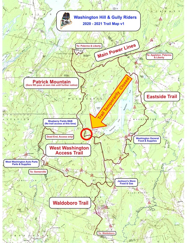
40 miles of trails in Washington and Liberty Hill & Gully Riders Washington Hill & Gully Riders is a snowmobile club in mid-coast Maine. We maintain 40 miles of trails in Washington and Liberty. We meet the second Tuesday of each month at 7:00 p.m. at the Washington Fire Department.
Moonlite Sno-Skimmers Trail Map Cumberland / North Yarmouth

Cumberland / North Yarmouth, ME Trails We maintain over 30 miles of snowmobile trails in Cumberland and North Yarmouth. With the help of our members and volunteers, we provide snowmobile riders with a safe and scenic trail system. We also acknowledge and thank our generous landowners who allow trails to cross their land. They are […]
Fort Kent Snoriders, Inc. SC – Carter Brook/ Frenchville/ Fort Kent
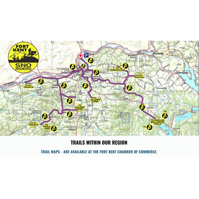
Carter Brook, Frenchville, Fort Kent, ME Fort Kent Snoriders Trail 73A: Starts on ITS 85 (Carter Brook Section) approximately 4 miles south of Heritage trail intersection (ITS 85/ITS 92). The trail travels east along the Michaud Rd crossing Rt. 11 and continues east to connect with Soldier Pond trails. Trail 73B: Starts on ITS 85 […]
Katahdin Chamber of Commerce Trail Maps
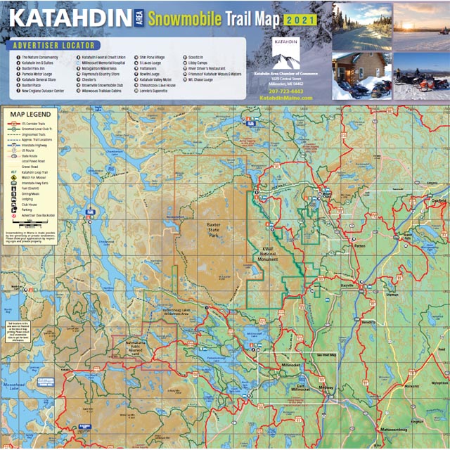
Katahdin Region, ME The Katahdin Chamber of Commerce region offers more than 350 miles of groomed snowmobiling trails making for some of the most spectacular snowmobiling on the East Coast. With easy access from I-95 and an average snowfall of 100 inches or more, the Katahdin Region is a true snowmobiling paradise. Download our 2021 […]
Forks Trails Club

The Forks Area Trail Map Maps are available in the main lodge for a small donation to The Forks Area Trail Club. ITS 86 from Berry’s Store in West Forks heading east toward Greenville. We turn around about 14 miles before Greenville. ITS 87 heading south toward Bingham. We turn around 15 miles from Bingham. […]